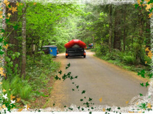
Promontory Park Campground
- PGE has requested that we respect their 10pm quiet time restriction.
- Only registered campers are allowed in the campgrounds.
- Parking is limited to two vehicles per site
- Gnomes and cabins are not available to reserve.
- Trailer and extra vehicle parking is available in outside the cmpagrounds but inside the locked gate.
- Wood will be available to purchase at the check in office during office hours. burning of debris or debris piles is NOT ALLOWED
Promontory Park Campground Website
40600 SE Highway 224
Estacada, OR 97023
Lockaby Campground – Partially Open for 2024 Event. More information coming soon.
Description: 900-foot elevation. 30 campsites on the Wild & Scenic Clackamas River. Fishing for steelhead, chinook & coho salmon. From just below Indian Henry campground to the North Fork Reservoir, the river contains 12.5 miles of Class III-IV whitewater. Season: May 11 – September 15.
Driving Directions GPS Coordinates:
GPS Info. (Latitude, Longitude):
45.16583, -122.15139
45°9’57″N, 122°9’5″W
From Estacada, take Highway 224 east for 15 miles to Lockaby campground on the left after crossing Carter Bridge.
Campground Phone Numbers:
Armstrong Campground -Partially Open for 2024 Event. More information coming soon.
Description: 900-foot elevation. 12 campsites on the Wild & Scenic Clackamas River. Fishing for steelhead, chinook & coho salmon. From just below Indian Henry campground to the North Fork Reservoir, the river is 12.5 miles of Class III-IV whitewater. Season: April 13 – September 15. Fishing Hiking/Backpacking Boating (WW) Drinking Water RV Sites Restrooms. Notes: See Oregon fishing regulations for specific regulations governing fishing in the Clackamas. 16-foot maximum RV length.

Driving Direction GPS Coordinates:
GPS Info. (Latitude, Longitude):
45.16278, -122.15167
45°9’46″N, 122°9’6″W
From Estacada, travel east on Highway 224 for 14 miles to Armstrong Campground, on the right after crossing Carter Bridge.
Campground Phone Numbers:
Fish Creek Campground -Closed due to fire damage
Description: 900-foot elevation. 25 campsites on the Wild & Scenic Clackamas River. Fishing for steelhead, chinook & coho salmon. From just below Indian Henry campground to the North Fork Reservoir, the river is 12.5 miles of Class III-IV whitewater. Season: May 11 – September 22. Fishing Hiking/Backpacking Boating (WW) Drinking Water and Restrooms.
Driving Direction GPS Coordinates:
GPS Info. (Latitude, Longitude):
45.15889, -122.15167
45°9’32″N, 122°9’6″W
From Estacada, travel east on Highway 224 for approximately 16 miles.
Campground Phone Numbers:
Phone: (503) 630-8700
*Possible additional camping can reserved at the below campgrounds.*
Metzler Park
Metzler Park is located approximately five miles south of Estacada along beautiful Clear Creek. Although it is a short drive from several communities in Clackamas County, this park feels wonderfully isolated, surrounded by hills covered with towering Douglas-fir and western red cedar trees.
Metzler Park Campground Website for Reservations
4526 S. Metzler Park Road
Estacada, OR 97023
Campground Phone Number:
503-742-4414